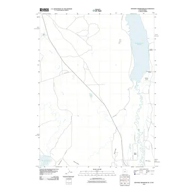
2010 Map of Neponset Reservoir NE
USGS Topo · Published 2010About this map
The Bear River meanders in tight oxbows through the high desert landscape of Uinta County in this 2010 topographic record. To the north, the Woodruff Narrows Reservoir dominates the drainage basin, while the Neponset Reservoir sits at the southwestern corner, reflecting the region's critical water management infrastructure. Between these water bodies, the terrain is marked by distinctive geological features including Murphy Ridge and various named drainages like Shell Hollow, Stacey Hollow, and Murphy Hollow.
Find a feature on this map
23 named features on this map. Tap any name to fly to it.
Don’t see what you’re looking for? This feature index may not catch every label — zoom into the map to look around manually.
Map Details
Editions of this 2010 Neponset Reservoir NE Map
This is the sole edition of this map. No revisions or reprints were ever made.
Other maps of this area

1912 · Randolph
USGS Topo · 1:125,000

1954 · Ogden
USGS Topo · 1:250,000

1958 · Ogden
USGS Topo · 1:250,000

1960 · Ogden
USGS Topo · 1:250,000

1962 · Sawtooth Mountain
USGS Topo · 1:24,000

1965 · Evanston
USGS Topo · 1:24,000

1965 · Three Forks
USGS Topo · 1:24,000

1968 · Woodruff
USGS Topo · 1:24,000

1968 · Mc Kay Hollow
USGS Topo · 1:24,000

1968 · Neponset Reservoir NE
USGS Topo · 1:24,000