
1965 Map of Three Forks
USGS Topo · Published 1968About this map
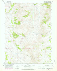
Three Forks emerges as the hydrographic center of this Uinta County landscape, where the Middle Fork, North Fork, and South Fork converge. The terrain is defined by a series of named drainages and topographic landmarks including Acock Canyon, Christensen Hollow, and the winding Whitney Canyon. Evidence of mid-century land use is visible through the presence of various Prospects and a Claypit, indicating small-scale mineral exploration or extraction. Water sources are meticulously documented, from the high-elevation School Section Spring and Section 2 Spring to the lower Whitney Springs Creek. A prominent Jeep Trail traverses the higher ridges between Salt Creek and the canyon systems, reflecting the necessity of rugged transit in this high-altitude Wyoming territory. This 1965 field-checked survey provides a clear view of the complex drainage network and early industrial footprints before more modern development reached this part of the county.
Find a feature on this map
26 named features on this map. Tap any name to fly to it.
Don’t see what you’re looking for? This feature index may not catch every label — zoom into the map to look around manually.
Map Details
Editions of this 1965 Three Forks Map
3 editions found
Other maps of this area

1912 · Randolph
USGS Topo · 1:125,000

1954 · Ogden
USGS Topo · 1:250,000

1958 · Ogden
USGS Topo · 1:250,000

1960 · Ogden
USGS Topo · 1:250,000

1962 · Sawtooth Mountain
USGS Topo · 1:24,000

1962 · Bell Butte
USGS Topo · 1:24,000

1965 · Evanston
USGS Topo · 1:24,000

1965 · Little Dee Creek
USGS Topo · 1:24,000

1965 · Guild Hollow
USGS Topo · 1:24,000

1968 · Neponset Reservoir NE
USGS Topo · 1:24,000