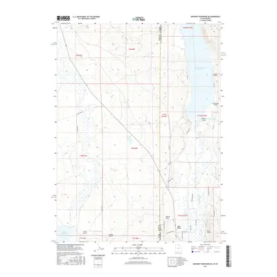
2017 Map of Neponset Reservoir NE
USGS Topo · Published 2017About this map
The Bear River winds along the Utah and Wyoming border, defining a landscape of complex water management and high-country ranching. This area near the Rich County and Uinta County line shows the vital infrastructure of the American West, where the Chapman Canal and Lee Ditch divert water across the basin to support local agriculture. The northern portion is dominated by the Woodruff Narrows Reservoir, a significant catchment area for the region's river system.
Find a feature on this map
45 named features on this map. Tap any name to fly to it.
Don’t see what you’re looking for? This feature index may not catch every label — zoom into the map to look around manually.
Map Details
Editions of this 2017 Neponset Reservoir NE Map
This is the sole edition of this map. No revisions or reprints were ever made.
Other maps of this area

1912 · Randolph
USGS Topo · 1:125,000

1954 · Ogden
USGS Topo · 1:250,000

1958 · Ogden
USGS Topo · 1:250,000

1960 · Ogden
USGS Topo · 1:250,000

1962 · Sawtooth Mountain
USGS Topo · 1:24,000

1965 · Evanston
USGS Topo · 1:24,000

1965 · Three Forks
USGS Topo · 1:24,000

1968 · Woodruff
USGS Topo · 1:24,000

1968 · Mc Kay Hollow
USGS Topo · 1:24,000

1968 · Neponset Reservoir NE
USGS Topo · 1:24,000