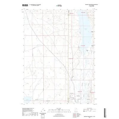
2020 Map of Neponset Reservoir NE
USGS Topo · Published 2020About this map
Bear River dominates the eastern drainage of this high-altitude borderland, where the state lines of Utah and Wyoming intersect. The landscape is defined by its water management infrastructure, most notably the Woodruff Narrows Reservoir and the Neponset Reservoir at the southern edge. This 2020 survey details a complex network of irrigation and water transit, including the Lee Ditch and Chapman Canal, which support the agricultural life of the valley.
Find a feature on this map
39 named features on this map. Tap any name to fly to it.
Don’t see what you’re looking for? This feature index may not catch every label — zoom into the map to look around manually.
Map Details
Editions of this 2020 Neponset Reservoir NE Map
This is the sole edition of this map. No revisions or reprints were ever made.
Other maps of this area

1912 · Randolph
USGS Topo · 1:125,000

1954 · Ogden
USGS Topo · 1:250,000

1958 · Ogden
USGS Topo · 1:250,000

1960 · Ogden
USGS Topo · 1:250,000

1962 · Sawtooth Mountain
USGS Topo · 1:24,000

1965 · Evanston
USGS Topo · 1:24,000

1965 · Three Forks
USGS Topo · 1:24,000

1968 · Woodruff
USGS Topo · 1:24,000

1968 · Mc Kay Hollow
USGS Topo · 1:24,000

1968 · Neponset Reservoir NE
USGS Topo · 1:24,000