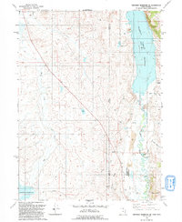
1991 Map of Neponset Reservoir NE
USGS Topo · Published 1991About this map
The Bear River winds through the high desert of the Utah and Wyoming border, defining a landscape shaped by water management and ranching. This 1991 revision, based on aerial photographs from the mid-1960s and 1980s, shows the scale of the Woodruff Narrows Reservoir and the smaller Neponset Reservoir to the south. The diversion of water is evident in the prominent Chapman Canal and various ditches that support the arid region's agricultural needs. Near the base of Murphy Ridge, the Wyoming Downs complex stands out as a focal point of development alongside a Trailer Park. Significant terrain features like Whitney Canyon Creek and Christensen Hollow break the plateau to the east, while the presence of an Oil Well and multiple gravel pits points to the local industrial extraction economy.
Find a feature on this map
23 named features on this map. Tap any name to fly to it.
Don’t see what you’re looking for? This feature index may not catch every label — zoom into the map to look around manually.
Map Details
Editions of this 1991 Neponset Reservoir NE Map
This is the sole edition of this map. No revisions or reprints were ever made.
Other maps of this area

1912 · Randolph
USGS Topo · 1:125,000

1954 · Ogden
USGS Topo · 1:250,000

1958 · Ogden
USGS Topo · 1:250,000

1960 · Ogden
USGS Topo · 1:250,000

1962 · Sawtooth Mountain
USGS Topo · 1:24,000

1965 · Evanston
USGS Topo · 1:24,000

1965 · Three Forks
USGS Topo · 1:24,000

1968 · Woodruff
USGS Topo · 1:24,000

1968 · Mc Kay Hollow
USGS Topo · 1:24,000

1968 · Neponset Reservoir NE
USGS Topo · 1:24,000