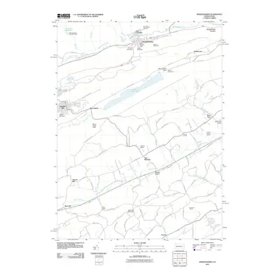
2010 Map of Nesquehoning
USGS Topo · Published 2010About this map
Nesquehoning and Summit Hill anchor the high ground in this 2010 topographic study, which illustrates the region's complex terrain and legacy of industrial water management. The northern reaches are defined by the Broad Run Reservoir and the Nesquehoning 4th Hollow Dam, while the long central valley is dominated by Mauch Chunk Lake and the Mauch Chunk Dam. This landscape is physically punctuated by geological gaps such as Rhume Run Gap and Hell Kitchen Gap near Indian Mountain.
Find a feature on this map
97 named features on this map. Tap any name to fly to it.
Don’t see what you’re looking for? This feature index may not catch every label — zoom into the map to look around manually.
Map Details
Editions of this 2010 Nesquehoning Map
This is the sole edition of this map. No revisions or reprints were ever made.
Other maps of this area

1889 · Hazleton
USGS Topo · 1:62,500

1891 · Hazleton
USGS Topo · 1:62,500

1893 · Hazleton
USGS Topo · 1:62,500

1902 · Slatington
USGS Topo · 1:62,500

1909 · Hamburg
USGS Topo · 1:62,500

1911 · Hamburg
USGS Topo · 1:62,500

1922 · Mauch Chunk
USGS Topo · 1:62,500

1924 · Mauch Chunk
USGS Topo · 1:62,500

1937 · Allentown West
USGS Topo · 1:48,000

1942 · Allentown West
USGS Topo · 1:62,500