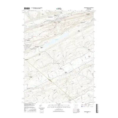
2016 Map of Nesquehoning
USGS Topo · Published 2016About this map
Broad Mountain and Nesquehoning Mountain dominate this landscape in the anthracite region of eastern Pennsylvania, where the terrain dictates the narrow corridors of human settlement. The northern half of the map is defined by the steep ridges and deep gaps of the Panther Creek Valley, including Hell Kitchen Gap and Rhume Run Gap, which provided essential passages for transportation and industry. In the valley floors, densely packed street grids in Nesquehoning and Lansford contrast with the agricultural character of Strauss Valley to the south.
Find a feature on this map
126 named features on this map. Tap any name to fly to it.
Don’t see what you’re looking for? This feature index may not catch every label — zoom into the map to look around manually.
Map Details
Editions of this 2016 Nesquehoning Map
This is the sole edition of this map. No revisions or reprints were ever made.
Other maps of this area

1889 · Hazleton
USGS Topo · 1:62,500

1891 · Hazleton
USGS Topo · 1:62,500

1893 · Hazleton
USGS Topo · 1:62,500

1902 · Slatington
USGS Topo · 1:62,500

1909 · Hamburg
USGS Topo · 1:62,500

1911 · Hamburg
USGS Topo · 1:62,500

1922 · Mauch Chunk
USGS Topo · 1:62,500

1924 · Mauch Chunk
USGS Topo · 1:62,500

1937 · Allentown West
USGS Topo · 1:48,000

1942 · Allentown West
USGS Topo · 1:62,500