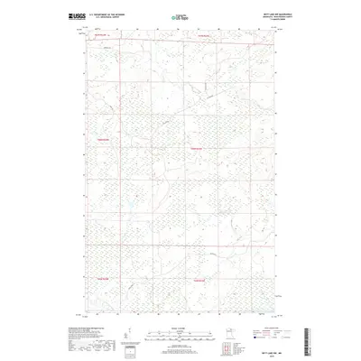
2019 Map of Nett Lake NW
USGS Topo · Published 2019About this map
Nett Lake River winds through the southern reaches of this Koochiching County terrain, leading toward the edge of Nett Lake. The landscape is defined by vast wetland systems and timberlands, segmented by the Public Land Survey System grids of T66N and T67N. A sparse network of roads provides access to the interior, including Biondich Rd and Haney Rd in the northwest, and Ash Lake Rd cutting through the central sections. Farther south, Resvn Hwy 5 serves as a primary corridor through the low-lying marshlands. This survey illustrates the modern management of these northern forests, where named tracks like Cutacross Rd hint at the utility and transit patterns required to navigate this water-dominant geography.
Find a feature on this map
13 named features on this map. Tap any name to fly to it.
Don’t see what you’re looking for? This feature index may not catch every label — zoom into the map to look around manually.
Map Details
Editions of this 2019 Nett Lake NW Map
This is the sole edition of this map. No revisions or reprints were ever made.
Other maps of this area

1954 · International Falls
USGS Topo · 1:250,000

1957 · International Falls
USGS Topo · 1:250,000

1958 · International Falls
USGS Topo · 1:250,000

1969 · Ray SE
USGS Topo · 1:24,000

1969 · Nett Lake
USGS Topo · 1:24,000

1969 · Ericsburg SE
USGS Topo · 1:24,000

1969 · Ray SW
USGS Topo · 1:24,000

1969 · Nett Lake NE
USGS Topo · 1:24,000

1970 · Nett Lake River SE
USGS Topo · 1:24,000
1970 · Nett Lake River East
USGS Topo · 1:24,000