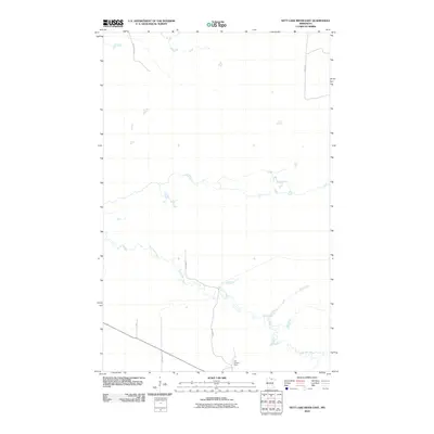
2010 Map of Nett Lake River East
USGS Topo · Published 2010About this map
Nett Lake River winds through this sparsely settled corner of Koochiching County, its meandering course forming the primary geographic feature across a landscape of low-lying wetlands and intermittent ponds. The area's infrastructure is concentrated in the southern and eastern reaches, anchored by the Fort Lookout Tower. A network of reservation and local roads, including Res Hwy 8 and Res Hwy 2, provides access through the timbered terrain. The presence of routes like Old Galvin Ln and Haney Rd suggests the historical importance of logging and resource management in this northern Minnesota wilderness, where the natural water drainage patterns remain largely undisturbed by modern development.
Find a feature on this map
7 named features on this map. Tap any name to fly to it.
Don’t see what you’re looking for? This feature index may not catch every label — zoom into the map to look around manually.
Map Details
Editions of this 2010 Nett Lake River East Map
This is the sole edition of this map. No revisions or reprints were ever made.
Other maps of this area

1954 · International Falls
USGS Topo · 1:250,000

1957 · International Falls
USGS Topo · 1:250,000

1958 · International Falls
USGS Topo · 1:250,000

1969 · Ericsburg SE
USGS Topo · 1:24,000

1969 · Ray SW
USGS Topo · 1:24,000

1969 · Ericsburg SW
USGS Topo · 1:24,000

1970 · Nett Lake River SE
USGS Topo · 1:24,000
1970 · Nett Lake River East
USGS Topo · 1:24,000
1970 · Nett Lake SW
USGS Topo · 1:24,000
1970 · Nett Lake River West
USGS Topo · 1:24,000