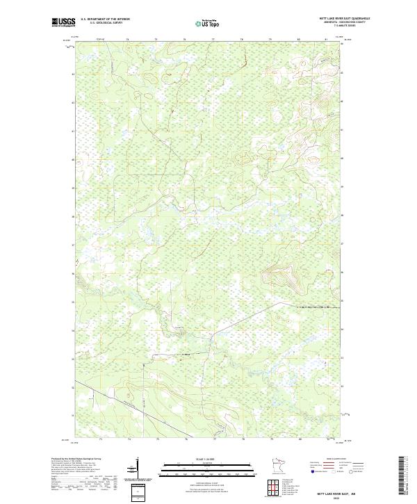
2022 Map of Nett Lake River East
USGS Topo · Published 2022About this map
Nett Lake River meanders through this portion of Koochiching County, defining a landscape dominated by extensive wetlands and subtle topography. The area is characterized by a sparse network of roads and trails that traverse the marshy interior, including O'Leary Trl and Old Galvin Ln. Settlement patterns are minimal, with the southern portion of the quadrangle showing more development along Industrial Ave and Resvn Hwy 2. This survey reflects the modern management of these northern lands, where tribal and state routes like Resvn Hwy 801 provide essential access through the dense wetland complex. The mapping detail highlights the drainage patterns and the isolated nature of the few named roads, such as Haney Rd and Biondich Rd in the northeast, which serve the edge of this transition zone between water and forest.
Find a feature on this map
14 named features on this map. Tap any name to fly to it.
Don’t see what you’re looking for? This feature index may not catch every label — zoom into the map to look around manually.
Map Details
Editions of this 2022 Nett Lake River East Map
This is the sole edition of this map. No revisions or reprints were ever made.
Other maps of this area

1954 · International Falls
USGS Topo · 1:250,000

1957 · International Falls
USGS Topo · 1:250,000

1958 · International Falls
USGS Topo · 1:250,000

1969 · Ericsburg SE
USGS Topo · 1:24,000

1969 · Ray SW
USGS Topo · 1:24,000

1969 · Ericsburg SW
USGS Topo · 1:24,000

1970 · Nett Lake River SE
USGS Topo · 1:24,000
1970 · Nett Lake River East
USGS Topo · 1:24,000
1970 · Nett Lake SW
USGS Topo · 1:24,000
1970 · Nett Lake River West
USGS Topo · 1:24,000