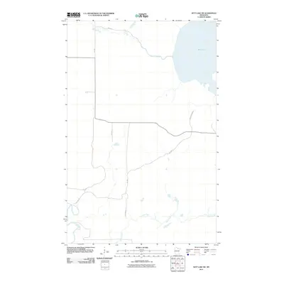
2010 Map of Nett Lake SW
USGS Topo · Published 2010About this map
Nett Lake dominates the northeast corner of this Koochiching County landscape, serving as the headwaters for the westward-winding Nett Lake River. This 2010 survey illustrates a sparsely populated region of Northern Minnesota defined by its intricate drainage systems and a dedicated network of tribal and reservation roads. The southern portion of the quadrangle is marked by the meandering path of Prairie Creek and the Little Fork River, which cuts through the southwestern corner. Transportation in this area relies heavily on routes such as Reservation Hwy 3 and Res Hwy 7, reflecting the management of the land by the U.S. Department of the Interior. The map provides a clear view of the natural watercourse patterns before they join larger systems beyond the quadrangle's borders.
Find a feature on this map
12 named features on this map. Tap any name to fly to it.
Don’t see what you’re looking for? This feature index may not catch every label — zoom into the map to look around manually.
Map Details
Editions of this 2010 Nett Lake SW Map
This is the sole edition of this map. No revisions or reprints were ever made.
Other maps of this area

1954 · Hibbing
USGS Topo · 1:250,000

1954 · International Falls
USGS Topo · 1:250,000

1957 · Hibbing
USGS Topo · 1:250,000

1957 · International Falls
USGS Topo · 1:250,000

1958 · International Falls
USGS Topo · 1:250,000

1958 · Hibbing
USGS Topo · 1:250,000

1964 · Hibbing
USGS Topo · 1:250,000

1969 · Nett Lake
USGS Topo · 1:24,000

1969 · Nett Lake NE
USGS Topo · 1:24,000

1970 · Rauch
USGS Topo · 1:24,000