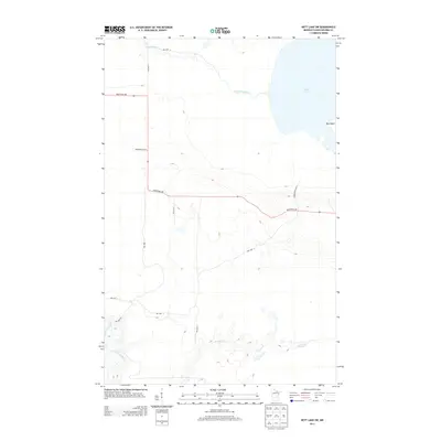
2013 Map of Nett Lake SW
USGS Topo · Published 2013About this map
Nett Lake dominates the northeastern corner of this northern Minnesota landscape, where the shoreline gives way to the prominent Big Island. This region is defined by its extensive water systems and the heavy presence of reservation infrastructure, with the Nett Lake River flowing westward from the main body of water. To the south, the meandering Prairie Cr and the winding Little Fork River cut through the low-lying terrain, illustrating the complex drainage patterns of the Koochiching County wilderness. The road network is primarily composed of tribal and industrial routes, such as Industrial Ave and several reservation highways including Reservation Hwy 9 and Reservation Hwy 3, which facilitate transit through this sparsely settled territory. These corridors highlight the intersection of natural resources and land management in the early twenty-first century.
Find a feature on this map
15 named features on this map. Tap any name to fly to it.
Don’t see what you’re looking for? This feature index may not catch every label — zoom into the map to look around manually.
Map Details
Editions of this 2013 Nett Lake SW Map
This is the sole edition of this map. No revisions or reprints were ever made.
Other maps of this area

1954 · Hibbing
USGS Topo · 1:250,000

1954 · International Falls
USGS Topo · 1:250,000

1957 · Hibbing
USGS Topo · 1:250,000

1957 · International Falls
USGS Topo · 1:250,000

1958 · International Falls
USGS Topo · 1:250,000

1958 · Hibbing
USGS Topo · 1:250,000

1964 · Hibbing
USGS Topo · 1:250,000

1969 · Nett Lake
USGS Topo · 1:24,000

1969 · Nett Lake NE
USGS Topo · 1:24,000

1970 · Rauch
USGS Topo · 1:24,000