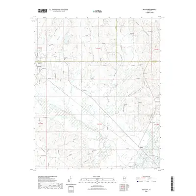
2020 Map of Nettleton
USGS Topo · Published 2020About this map
Nettleton sits at the intersection of Lee and Monroe counties, anchoring a landscape defined by its rural heritage and an extensive network of family-named cemeteries and landmarks. This 2020 survey reveals the complex drainage systems that shape the local geography, including the Tombigbee River and its various tributaries like Town Creek and Millhouse Ditch. The map illustrates the town's expansion along Airline Rd and Union Ave, while the surrounding terrain is dotted with ancestral sites such as Providence Cem and Grey Cem. Further south, the community of Bigbee rests near the river's edge, highlighting the historical importance of the waterway to the region's development. The grid of county roads, including Co Rd 122 and Co Rd 1277, provides a detailed look at how modern property lines and transportation corridors have evolved around these traditional Mississippi settlements.
Find a feature on this map
102 named features on this map. Tap any name to fly to it.
Don’t see what you’re looking for? This feature index may not catch every label — zoom into the map to look around manually.
Map Details
Editions of this 2020 Nettleton Map
This is the sole edition of this map. No revisions or reprints were ever made.
Other maps of this area

1953 · West Point
USGS Topo · 1:250,000

1956 · Tupelo
USGS Topo · 1:250,000

1958 · Tupelo
USGS Topo · 1:250,000

1958 · West Point
USGS Topo · 1:250,000

1963 · West Point
USGS Topo · 1:250,000

1965 · Egypt
USGS Topo · 1:24,000

1966 · Smithville
USGS Topo · 1:24,000

1966 · Beans Ferry
USGS Topo · 1:24,000

1966 · Shannon
USGS Topo · 1:24,000

1966 · Amory
USGS Topo · 1:24,000