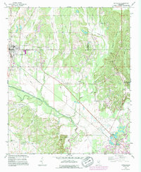
1992 Map of Nettleton
USGS Topo · Published 1995About this map
Nettleton sits at the junction of Lee and Monroe counties, serving as a primary settlement point in this agricultural and industrial landscape during the early 1990s. The map illustrates a complex drainage system led by Town Creek and its many tributaries, including Wolf Creek and Shoaf Creek, which carve through the lowlands towards the southeast. A notable feature of the regional economy is the Goodwin Gas Field and several scattered extractive sites such as Claypit and various Gravel Pits.
Find a feature on this map
48 named features on this map. Tap any name to fly to it.
Don’t see what you’re looking for? This feature index may not catch every label — zoom into the map to look around manually.
Map Details
Editions of this 1992 Nettleton Map
This is the sole edition of this map. No revisions or reprints were ever made.
Other maps of this area

1953 · West Point
USGS Topo · 1:250,000

1956 · Tupelo
USGS Topo · 1:250,000

1958 · Tupelo
USGS Topo · 1:250,000

1958 · West Point
USGS Topo · 1:250,000

1963 · West Point
USGS Topo · 1:250,000

1965 · Egypt
USGS Topo · 1:24,000

1966 · Smithville
USGS Topo · 1:24,000

1966 · Beans Ferry
USGS Topo · 1:24,000

1966 · Shannon
USGS Topo · 1:24,000

1966 · Amory
USGS Topo · 1:24,000