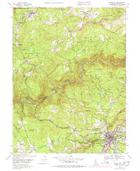
1948 Map of Nevada City
USGS Topo · Published 1978About this map
Nevada City serves as the focal point for this post-war landscape, situated where the terrain transitions from industrial town-site to the steep canyons of the South Fork Yuba River. The map reveals the extensive hydraulic mining legacy of the region, clearly marking the massive Cherokee Diggings and numerous areas of Tailings that reshaped the natural drainage. This industrial imprint is further evidenced by a complex network of water infrastructure, including the Excelsior Ditch and Rough and Ready Ditch, which were critical for both mining and agricultural operations.
Find a feature on this map
62 named features on this map. Tap any name to fly to it.
Don’t see what you’re looking for? This feature index may not catch every label — zoom into the map to look around manually.
Map Details
Editions of this 1948 Nevada City Map
4 editions found
Other maps of this area

1888 · Smartsville
USGS Topo · 1:125,000

1891 · Colfax
USGS Topo · 1:125,000

1891 · Smartsville
USGS Topo · 1:125,000

1892 · Smartsville
USGS Topo · 1:125,000

1892 · Colfax
USGS Topo · 1:125,000

1894 · Colfax
USGS Topo · 1:125,000

1894 · Smartsville
USGS Topo · 1:125,000

1895 · Smartsville
USGS Topo · 1:125,000

1898 · Colfax
USGS Topo · 1:125,000

1900 · Colfax
USGS Topo · 1:125,000