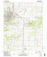
1991 Map of Nevada
USGS Topo · Published 1991About this map
The city of Nevada serves as a prominent regional hub in the early 1990s, anchored by the expansive Nevada State Hospital complex and the academic campus of Cottey College. This survey reveals a landscape where municipal growth meets institutional and military history, notably at the Camp Clark Military Reservation and the Camp Clark Training Site Missouri National Guard. The surrounding area is defined by its small-town connectivity, with Nassau Junction and the settlement of Milo situated along the rail lines and highways.
Find a feature on this map
53 named features on this map. Tap any name to fly to it.
Don’t see what you’re looking for? This feature index may not catch every label — zoom into the map to look around manually.
Map Details
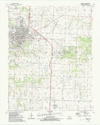
Editions of this 1991 Nevada Map
2 editions found
Other maps of this area

1886 · Nevada
USGS Topo · 1:125,000

1894 · Nevada
USGS Topo · 1:125,000

1933 · Camp Clark
USGS Topo · 1:24,000

1938 · Metz
USGS Topo · 1:24,000

1938 · Horton
USGS Topo · 1:24,000

1939 · Metz
USGS Topo · 1:24,000

1939 · Horton
USGS Topo · 1:24,000

1939 · Dederick
USGS Topo · 1:24,000
1939 · Harwood
USGS Topo · 1:24,000

1939 · Moundville
USGS Topo · 1:24,000