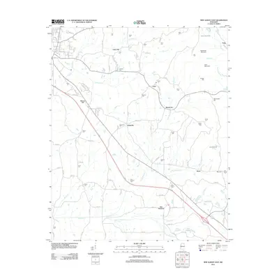
2012 Map of New Albany East
USGS Topo · Published 2012About this map
Biloxi National Cem and the surrounding rural communities define this portion of Union County in the early 21st century. The landscape is marked by a high density of local burial grounds and family-named landmarks, such as Wallersville Cem, Adair Cem, and Snider Cem, reflecting the deep-rooted genealogy of settlements like Wallerville and Union Hill. The terrain rises to notable elevations at Rakestraw Mountain and Briar Mountain in the northeast, while the lower drainage basins are shaped by the meandering Sand Cr and the various branches of Okannatie Cr. This survey illustrates the modern road network, including Denmill Rd and Ball Rd, providing a clear view of how residential growth has integrated with traditional landmarks like the Center Lookout Tower and Camp Armstrong near the community of Blue Cut.
Find a feature on this map
69 named features on this map. Tap any name to fly to it.
Don’t see what you’re looking for? This feature index may not catch every label — zoom into the map to look around manually.
Map Details
Editions of this 2012 New Albany East Map
This is the sole edition of this map. No revisions or reprints were ever made.
Other maps of this area

1949 · New Albany
USGS Topo · 1:62,500

1951 · New Albany
USGS Topo · 1:62,500

1955 · Ripley
USGS Topo · 1:62,500

1955 · Sherman
USGS Topo · 1:62,500

1955 · Blue Mountain
USGS Topo · 1:62,500

1956 · Tupelo
USGS Topo · 1:250,000

1958 · Tupelo
USGS Topo · 1:250,000

1980 · Northwest Pontotoc
USGS Topo · 1:24,000

1980 · New Albany West
USGS Topo · 1:24,000
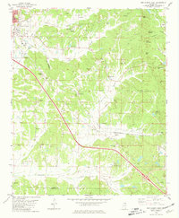
1980 · New Albany East
USGS Topo · 1:24,000