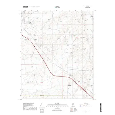
2018 Map of New Albany East
USGS Topo · Published 2018About this map
New Albany anchors the northwestern corner of this landscape, where residential streets like 3rd St and Garfield St give way to the complex topography of the Pontotoc Ridge. The terrain is defined by a series of distinct heights, including Rakestraw Mtn, Briar Mtn, and Beacon Hill, which separate the various branches of Okannatie Cr and King Cr. This 2018 survey reveals a rural infrastructure deeply connected to its local history, evidenced by the numerous family and community burial grounds such as Adair Cem, Wallersville Cem, and Snider Cem. Small settlements like Wallerville, Mound City, and Blue Springs are interspersed throughout the hills, connected by a network of county roads. The southern portion of the map is marked by the Union and Pontotoc County line, crossing through the community of New Harmony near the winding waters of Caldwell Cr and Popular Springs Cr.
Find a feature on this map
115 named features on this map. Tap any name to fly to it.
Don’t see what you’re looking for? This feature index may not catch every label — zoom into the map to look around manually.
Map Details
Editions of this 2018 New Albany East Map
This is the sole edition of this map. No revisions or reprints were ever made.
Other maps of this area

1949 · New Albany
USGS Topo · 1:62,500

1951 · New Albany
USGS Topo · 1:62,500

1955 · Ripley
USGS Topo · 1:62,500

1955 · Sherman
USGS Topo · 1:62,500

1955 · Blue Mountain
USGS Topo · 1:62,500

1956 · Tupelo
USGS Topo · 1:250,000

1958 · Tupelo
USGS Topo · 1:250,000

1980 · Northwest Pontotoc
USGS Topo · 1:24,000

1980 · New Albany West
USGS Topo · 1:24,000
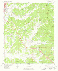
1980 · New Albany East
USGS Topo · 1:24,000