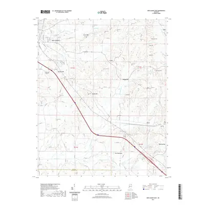
2021 Map of New Albany East
USGS Topo · Published 2021About this map
New Albany anchors the northwestern corner of this landscape, where the town's residential streets like Highland St and E Bankhead St give way to the undulating terrain of eastern Union County. The area is defined by a dense network of family and community landmarks, particularly a notable concentration of small cemeteries such as Adair Cem, Lebanon Cem, and Snider Cem that suggest a long-established rural settlement pattern. The terrain rises to distinct heights at Rakestraw Mtn and Briar Mtn in the northeast, while the southern half of the map is shaped by the drainages of Okannatie Cr and Caldwell Cr. Small unincorporated communities like Wallerville, New Harmony, and Blue Springs are connected by a web of county roads, with Mound City and Center serving as central points between the creek bottoms and the higher ridges of Beacon Hill and Luke Hill.
Find a feature on this map
120 named features on this map. Tap any name to fly to it.
Don’t see what you’re looking for? This feature index may not catch every label — zoom into the map to look around manually.
Map Details
Editions of this 2021 New Albany East Map
This is the sole edition of this map. No revisions or reprints were ever made.
Other maps of this area

1949 · New Albany
USGS Topo · 1:62,500

1951 · New Albany
USGS Topo · 1:62,500

1955 · Ripley
USGS Topo · 1:62,500

1955 · Sherman
USGS Topo · 1:62,500

1955 · Blue Mountain
USGS Topo · 1:62,500

1956 · Tupelo
USGS Topo · 1:250,000

1958 · Tupelo
USGS Topo · 1:250,000

1980 · Northwest Pontotoc
USGS Topo · 1:24,000

1980 · New Albany West
USGS Topo · 1:24,000
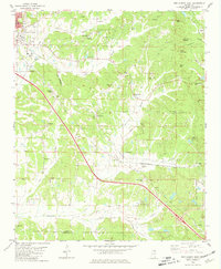
1980 · New Albany East
USGS Topo · 1:24,000