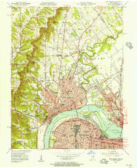
1955 Map of New Albany
USGS Topo · Published 1956About this map
The Ohio River serves as the focal point for this mid-century survey, dividing the urban centers of New Albany and Louisville. This era reveals a dense network of transit and industry, centered around the Falls of the Ohio and the massive rail yards of the Kentucky and Indiana Terminal RR. The map captures the complex riverfront infrastructure before modern redevelopment, including the Toll Bridge and the George Rogers Clark Memorial Bridge connecting Indiana and Kentucky.
Find a feature on this map
101 named features on this map. Tap any name to fly to it.
Don’t see what you’re looking for? This feature index may not catch every label — zoom into the map to look around manually.
Map Details
Editions of this 1955 New Albany Map
This is the sole edition of this map. No revisions or reprints were ever made.
Other maps of this area

1905 · Prospect
USGS Topo · 1:62,500

1907 · Louisville
USGS Topo · 1:62,500

1909 · Kosmosdale
USGS Topo · 1:48,000

1912 · Prospect
USGS Topo · 1:62,500

1912 · Kosmosdale
USGS Topo · 1:62,500

1937 · Jeffersonville
USGS Topo · 1:24,000

1937 · Charlestown
USGS Topo · 1:24,000

1938 · Speed
USGS Topo · 1:24,000

1939 · New Albany
USGS Topo · 1:24,000

1939 · Georgetown
USGS Topo · 1:24,000