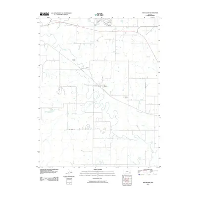
2010 Map of New Albany
USGS Topo · Published 2010About this map
Fall River meanders across this corner of Wilson County, defining the agricultural and rural character of the landscape near the small community of New Albany. The settlement sits at a confluence where Indian Creek meets the river, its grid of streets such as Mill St and 1st St N providing a structured anchor amidst the winding waterways. The map is particularly rich for family historians, documenting several burial grounds including Weakley Cemetery to the east and Jackson Cemetery and Old Tailor Cemetery to the northwest. The presence of Oil Field Lease Rd suggests a landscape shaped by local extraction alongside traditional farming. Further north, the intersection of US Hwy 400 and residential clusters like Lakeshore Dr highlights the area's modern infrastructure and development patterns near Saint Francis Cemetery.
Find a feature on this map
24 named features on this map. Tap any name to fly to it.
Don’t see what you’re looking for? This feature index may not catch every label — zoom into the map to look around manually.
Map Details
Editions of this 2010 New Albany Map
This is the sole edition of this map. No revisions or reprints were ever made.
Other maps of this area

1885 · Eureka
USGS Topo · 1:125,000

1885 · Sedan
USGS Topo · 1:125,000

1886 · Fredonia
USGS Topo · 1:125,000

1886 · Independence
USGS Topo · 1:125,000

1888 · Eureka
USGS Topo · 1:125,000

1889 · Sedan
USGS Topo · 1:125,000

1894 · Fredonia
USGS Topo · 1:125,000

1894 · Independence
USGS Topo · 1:125,000

1894 · Eureka
USGS Topo · 1:125,000

1905 · Independence
USGS Topo · 1:125,000