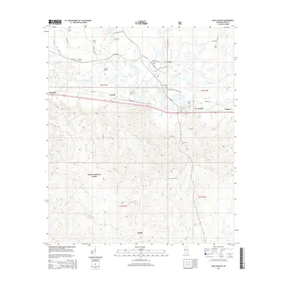
2015 Map of New Augusta
USGS Topo · Published 2015About this map
The Leaf River meanders across this Perry County landscape, defining the topography between the upland ridges and the lowland basins of south-central Mississippi. Near the river's bend, the town of New Augusta serves as a focal point for the surrounding rural communities of Mahned, Wingate, and Belleville. The area's transit history is anchored by the Mahned Bridge and a network of early routes such as Old River Rd and Old Augusta Rd.
Find a feature on this map
52 named features on this map. Tap any name to fly to it.
Don’t see what you’re looking for? This feature index may not catch every label — zoom into the map to look around manually.
Map Details
Editions of this 2015 New Augusta Map
This is the sole edition of this map. No revisions or reprints were ever made.
Other maps of this area

1947 · Beaumont
USGS Topo · 1:62,500

1947 · New Augusta
USGS Topo · 1:62,500

1949 · Beaumont
USGS Topo · 1:62,500

1949 · New Augusta
USGS Topo · 1:62,500

1953 · Hattiesburg
USGS Topo · 1:250,000

1958 · Hattiesburg
USGS Topo · 1:250,000

1964 · Carterville
USGS Topo · 1:24,000

1964 · Ovett SE
USGS Topo · 1:24,000

1964 · Richton
USGS Topo · 1:24,000
1982 · Beaumont
USGS Topo · 1:24,000