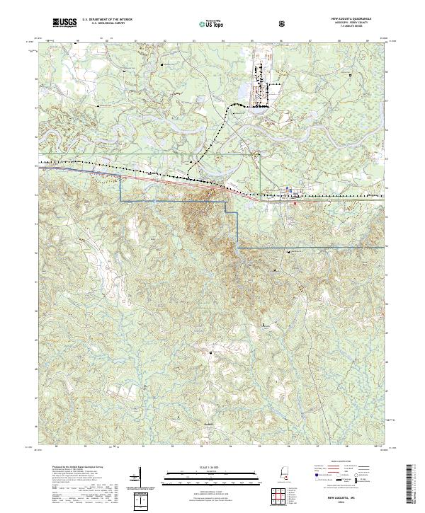
2024 Map of New Augusta
USGS Topo · Published 2024About this map
New Augusta serves as the focal point of this Mississippi landscape, situated along the Leaf River just south of its confluence with Tallabala Creek. The map documents the seat of local government at the Perry County Courthouse and traces the rural settlements of Mahned, Wingate, and Redhill. Much of the southern and western portions of the quadrangle are occupied by the extensive lands of the De Soto National Forest and the northern reaches of Camp Shelby, indicating the region's heavy reliance on timber and military activity. Genealogists will find a significant distribution of family and community burial grounds, including Good Hope Cem, Ferguson Cem, and Hinton Cem. The terrain is defined by a dense network of drainage, where Milky Creek and Cypress Creek carve through the forested lowlands, illustrating the natural water-driven geography of Perry County.
Find a feature on this map
54 named features on this map. Tap any name to fly to it.
Don’t see what you’re looking for? This feature index may not catch every label — zoom into the map to look around manually.
Map Details
Editions of this 2024 New Augusta Map
This is the sole edition of this map. No revisions or reprints were ever made.
Other maps of this area

1947 · Beaumont
USGS Topo · 1:62,500

1947 · New Augusta
USGS Topo · 1:62,500

1949 · Beaumont
USGS Topo · 1:62,500

1949 · New Augusta
USGS Topo · 1:62,500

1953 · Hattiesburg
USGS Topo · 1:250,000

1958 · Hattiesburg
USGS Topo · 1:250,000

1964 · Carterville
USGS Topo · 1:24,000

1964 · Ovett SE
USGS Topo · 1:24,000

1964 · Richton
USGS Topo · 1:24,000
1982 · Beaumont
USGS Topo · 1:24,000