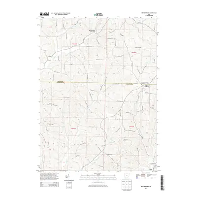
2013 Map of New Bedford
USGS Topo · Published 2013About this map
New Bedford sits at a high crossroads on the boundary of Holmes and Coshocton counties, serving as a focal point for this agrarian landscape. The terrain is defined by the deep drainage of Troyer Hollow and Becks Mills to the north, while the southern reaches are marked by the winding paths of Little Mill Cr and Beards Run. This area preserves a high density of early community sites, particularly religious and burial grounds that anchor the local genealogy. Notable locations include the Saint Johns Evangelical Lutheran Cem and Sheplers Evangelical Cem. The map reveals a highly developed network of township roads, such as Township Road 117 and Co Road 600, which connect scattered homesteads to the small settlements of Chili and Becks Mills.
Find a feature on this map
87 named features on this map. Tap any name to fly to it.
Don’t see what you’re looking for? This feature index may not catch every label — zoom into the map to look around manually.
Map Details
Editions of this 2013 New Bedford Map
This is the sole edition of this map. No revisions or reprints were ever made.
Other maps of this area

1911 · Newcomerstown
USGS Topo · 1:62,500

1913 · Newcomerstown
USGS Topo · 1:62,500

1913 · Coshocton
USGS Topo · 1:62,500

1914 · Navarre
USGS Topo · 1:62,500

1915 · Millersburg
USGS Topo · 1:62,500

1915 · Coshocton
USGS Topo · 1:62,500

1943 · Millersburg
USGS Topo · 1:62,500

1943 · Coshocton
USGS Topo · 1:62,500

1943 · Newcomerstown
USGS Topo · 1:62,500

1944 · Navarre
USGS Topo · 1:62,500