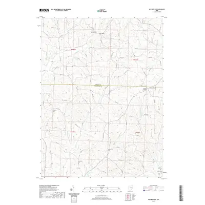
2019 Map of New Bedford
USGS Topo · Published 2019About this map
New Bedford sits at a crossroads on the boundary between Holmes Co and Coshocton Co, serving as a central hub for this rural landscape in the late 2010s. The region is characterized by a dense network of family and community landmarks, particularly evident in the high concentration of small cemeteries such as Oak Hill Cem, Zion Cem, and Sheplers Evangelical Cem. The terrain is carved by numerous waterways including Doughty Cr, Mullet Run, and Military Run, which flow through features like Troyer Hollow in the northern portion of the quadrangle.
Find a feature on this map
93 named features on this map. Tap any name to fly to it.
Don’t see what you’re looking for? This feature index may not catch every label — zoom into the map to look around manually.
Map Details
Editions of this 2019 New Bedford Map
This is the sole edition of this map. No revisions or reprints were ever made.
Other maps of this area

1911 · Newcomerstown
USGS Topo · 1:62,500

1913 · Newcomerstown
USGS Topo · 1:62,500

1913 · Coshocton
USGS Topo · 1:62,500

1914 · Navarre
USGS Topo · 1:62,500

1915 · Millersburg
USGS Topo · 1:62,500

1915 · Coshocton
USGS Topo · 1:62,500

1943 · Millersburg
USGS Topo · 1:62,500

1943 · Coshocton
USGS Topo · 1:62,500

1943 · Newcomerstown
USGS Topo · 1:62,500

1944 · Navarre
USGS Topo · 1:62,500