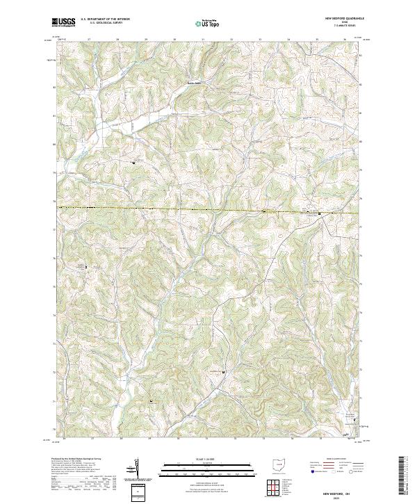
2023 Map of New Bedford
USGS Topo · Published 2023About this map
Becks Mills and the small settlement of Chili anchor this portion of the borderlands between Holmes and Coshocton Counties. The landscape is defined by the dissection of the plateau by numerous waterways, including Doughty Creek, Mill Creek, and the West Fork White Eyes Creek. The map reveals a dense network of township and county roads that follow the ridges and valleys, serving a rural population deeply rooted in the land. For genealogists and local historians, the sheet is particularly valuable for its documentation of numerous small burial sites and houses of worship. These include Saint Johns Evangelical Lutheran Cem, Sheplers Evangelical Cem, and Crossroads Church Cem. The distribution of these features across townships like t8n r6w and t7n r5w reflects a decentralized community structure typical of this part of Ohio, where family and faith were centered on local rural crossroads.
Find a feature on this map
101 named features on this map. Tap any name to fly to it.
Don’t see what you’re looking for? This feature index may not catch every label — zoom into the map to look around manually.
Map Details
Editions of this 2023 New Bedford Map
This is the sole edition of this map. No revisions or reprints were ever made.
Other maps of this area

1911 · Newcomerstown
USGS Topo · 1:62,500

1913 · Newcomerstown
USGS Topo · 1:62,500

1913 · Coshocton
USGS Topo · 1:62,500

1914 · Navarre
USGS Topo · 1:62,500

1915 · Millersburg
USGS Topo · 1:62,500

1915 · Coshocton
USGS Topo · 1:62,500

1943 · Millersburg
USGS Topo · 1:62,500

1943 · Coshocton
USGS Topo · 1:62,500

1943 · Newcomerstown
USGS Topo · 1:62,500

1944 · Navarre
USGS Topo · 1:62,500