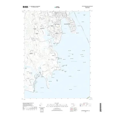
2018 Map of New Bedford South
USGS Topo · Published 2018About this map
New Bedford and its southern coastal neighborhoods are defined by a complex interface of rocky points and tidal inlets as they appeared in 2018. The urban grid of the city descends toward Clarks Point and the New Bedford - Oak Bluffs Ferry route, while to the west, the landscape transitions into the residential enclaves of Bliss Corner and South Dartmouth. This coastal geography is marked by numerous named hazards and landmarks, from the Dumpling Rocks to the expansive Bay View Marshes. Local history is anchored by significant sites like Saint Johns Cem and Rural Cem, providing clear points for genealogical research. The map captures a modern snapshot of longstanding maritime infrastructure, including the Plummer Memorial Bridge and the Intracoastal Waterway as they navigate the shoreline around Apponagansett Bay and the Slocums River.
Find a feature on this map
169 named features on this map. Tap any name to fly to it.
Don’t see what you’re looking for? This feature index may not catch every label — zoom into the map to look around manually.
Map Details
Editions of this 2018 New Bedford South Map
This is the sole edition of this map. No revisions or reprints were ever made.
Other maps of this area

1885 · New Bedford
USGS Topo · 1:62,500

1885 · Sakonnet
USGS Topo · 1:62,500

1887 · Gay Head
USGS Topo · 1:62,500

1888 · New Bedford
USGS Topo · 1:62,500

1888 · Fall River
USGS Topo · 1:62,500

1888 · Sakonnet
USGS Topo · 1:62,500

1889 · Gay Head
USGS Topo · 1:62,500

1893 · Gay Head
USGS Topo · 1:62,500

1893 · Sakonnet
USGS Topo · 1:62,500

1893 · Fall River
USGS Topo · 1:62,500