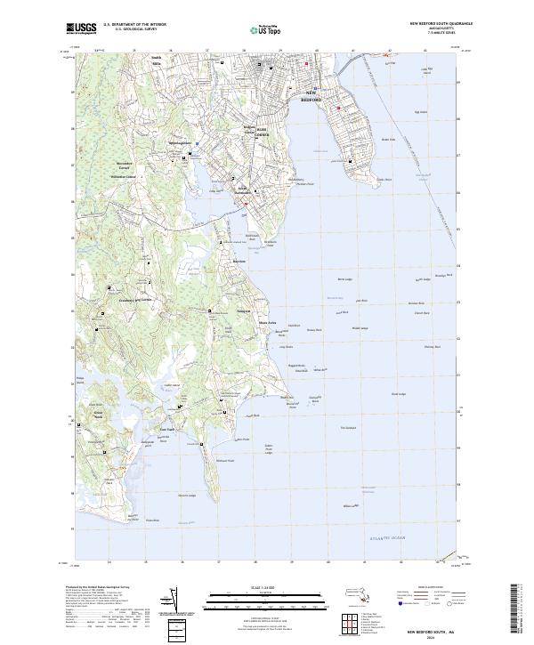
2024 Map of New Bedford South
USGS Topo · Published 2024About this map
New Bedford and its southern coastal reaches meet the Atlantic Ocean in this contemporary record of Bristol County’s shoreline. The map reveals a dense network of family-named burial grounds and historical corners, such as Redgate Corner and Bliss Corner, which anchor the residential development stretching toward the water. The geography is defined by the deep inlets of Clarks Cove and Apponagansett Bay, while the maritime character is emphasized by the New Bedford - Oak Bluffs Ferry route crossing the harbor.
Find a feature on this map
97 named features on this map. Tap any name to fly to it.
Don’t see what you’re looking for? This feature index may not catch every label — zoom into the map to look around manually.
Map Details
Editions of this 2024 New Bedford South Map
This is the sole edition of this map. No revisions or reprints were ever made.
Other maps of this area

1885 · New Bedford
USGS Topo · 1:62,500

1885 · Sakonnet
USGS Topo · 1:62,500

1887 · Gay Head
USGS Topo · 1:62,500

1888 · New Bedford
USGS Topo · 1:62,500

1888 · Fall River
USGS Topo · 1:62,500

1888 · Sakonnet
USGS Topo · 1:62,500

1889 · Gay Head
USGS Topo · 1:62,500

1893 · Gay Head
USGS Topo · 1:62,500

1893 · Sakonnet
USGS Topo · 1:62,500

1893 · Fall River
USGS Topo · 1:62,500