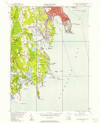
1948 Map of New Bedford South
USGS Topo · Published 1958About this map
New Bedford and Dartmouth meet along the shores of Buzzards Bay in this 1948 revision, capturing a landscape of coastal fortifications and expanding residential corners. The defensive posture of the harbor is anchored by Fort Rodman at Clark Point and Fort Phoenix across the water, with the Butler Flats Lighthouse marking the channel entrance. Inland, the map reveals the social fabric of the era through a dense network of neighborhood schools like the Cushman School and Taylor School, alongside community landmarks such as Acushnet Park and the Solemar Hospital.
Find a feature on this map
84 named features on this map. Tap any name to fly to it.
Don’t see what you’re looking for? This feature index may not catch every label — zoom into the map to look around manually.
Map Details
Editions of this 1948 New Bedford South Map
This is the sole edition of this map. No revisions or reprints were ever made.
Other maps of this area

1885 · New Bedford
USGS Topo · 1:62,500

1885 · Sakonnet
USGS Topo · 1:62,500

1887 · Gay Head
USGS Topo · 1:62,500

1888 · New Bedford
USGS Topo · 1:62,500

1888 · Fall River
USGS Topo · 1:62,500

1888 · Sakonnet
USGS Topo · 1:62,500

1889 · Gay Head
USGS Topo · 1:62,500

1893 · Gay Head
USGS Topo · 1:62,500

1893 · Sakonnet
USGS Topo · 1:62,500

1893 · Fall River
USGS Topo · 1:62,500