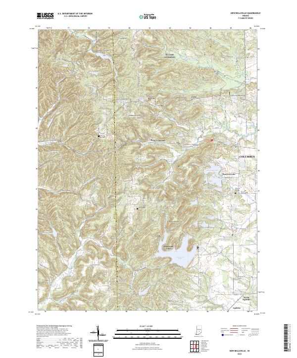
2022 Map of New Bellsville
USGS Topo · Published 2022About this map
The boundary between Brown Co and Bartholomew Co bisects a landscape defined by dramatic ridgelines and a high density of private and community lakes. The settlement of Stony Lonesome occupies the central heights, while the larger water bodies like Grandview Lake and Harrison Lake show the modern residential development patterns in this part of Indiana. Significant elevation changes are marked by prominent features such as Knob Hill, Guffy Hill, and Patterson Hill, which overlook the winding tributaries of East Fork Salt Creek.
Find a feature on this map
92 named features on this map. Tap any name to fly to it.
Don’t see what you’re looking for? This feature index may not catch every label — zoom into the map to look around manually.
Map Details
Editions of this 2022 New Bellsville Map
This is the sole edition of this map. No revisions or reprints were ever made.
Other maps of this area

1942 · Franklin
USGS Topo · 1:125,000

1942 · Columbus
USGS Topo · 1:125,000

1947 · Nashville
USGS Topo · 1:24,000

1947 · Franklin
USGS Topo · 1:62,500

1948 · Edinburg
USGS Topo · 1:24,000

1948 · New Bellsville
USGS Topo · 1:24,000

1948 · Waymansville
USGS Topo · 1:24,000

1948 · Nineveh
USGS Topo · 1:24,000

1948 · Fruitdale
USGS Topo · 1:24,000

1949 · Nashville
USGS Topo · 1:24,000