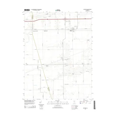
2015 Map of New Berlin
USGS Topo · Published 2015About this map
New Berlin serves as the primary hub in this central Illinois landscape, where the grain-belt economy is reflected in the dense network of rural roads and scattered historical landmarks. The map documents numerous burial sites vital for genealogical research, including Saint Mary's Catholic Cemetery, Smyrna Cemetery, and the Little Hope Cemetery. Smaller settlements such as Prouty, Huffaker, and Island Grove dot the prairie, while the terrain is defined by the winding paths of Spring Creek and Lick Creek. These watercourses create subtle drainage patterns across the farmland, occasionally interrupted by specialized sites like the Richardson Airport. This 2015 survey provides a modern baseline for tracing family lineages and the evolution of the Morgan and Sangamon County line, capturing the region's enduring agricultural character.
Find a feature on this map
73 named features on this map. Tap any name to fly to it.
Don’t see what you’re looking for? This feature index may not catch every label — zoom into the map to look around manually.
Map Details
Editions of this 2015 New Berlin Map
This is the sole edition of this map. No revisions or reprints were ever made.
Other maps of this area

1909 · Tallula
USGS Topo · 1:62,500

1924 · Waverly
USGS Topo · 1:62,500

1926 · Waverly
USGS Topo · 1:62,500

1932 · Jacksonville
USGS Topo · 1:62,500

1932 · Virginia
USGS Topo · 1:62,500

1936 · Virginia
USGS Topo · 1:62,500

1937 · Jacksonville
USGS Topo · 1:62,500

1940 · Tallula
USGS Topo · 1:62,500

1948 · Quincy
USGS Topo · 1:250,000

1956 · Quincy
USGS Topo · 1:250,000