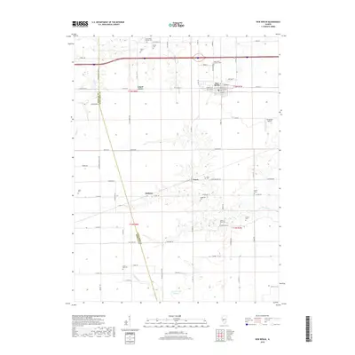
2018 Map of New Berlin
USGS Topo · Published 2018About this map
New Berlin serves as the primary hub on this central Illinois landscape, where the rectilinear grid of agricultural land is interrupted by the meandering courses of Spring Cr and Lick Cr. The survey illustrates a well-developed network of rural roads such as Old Rte 54 and Mansion Rd that connect smaller named localities like Island Grove and Huffaker. Genealogists will find a high density of burial sites scattered across the townships, ranging from church-affiliated grounds like Saint Mary's Catholic Cem and Saint John's Lutheran Cem to smaller family or local plots including Wilcox Cem, Foutch Cem, and Little York Cem.
Find a feature on this map
74 named features on this map. Tap any name to fly to it.
Don’t see what you’re looking for? This feature index may not catch every label — zoom into the map to look around manually.
Map Details
Editions of this 2018 New Berlin Map
This is the sole edition of this map. No revisions or reprints were ever made.
Other maps of this area

1909 · Tallula
USGS Topo · 1:62,500

1924 · Waverly
USGS Topo · 1:62,500

1926 · Waverly
USGS Topo · 1:62,500

1932 · Jacksonville
USGS Topo · 1:62,500

1932 · Virginia
USGS Topo · 1:62,500

1936 · Virginia
USGS Topo · 1:62,500

1937 · Jacksonville
USGS Topo · 1:62,500

1940 · Tallula
USGS Topo · 1:62,500

1948 · Quincy
USGS Topo · 1:250,000

1956 · Quincy
USGS Topo · 1:250,000