2024 Map of New Berlin
USGS Topo · Published 2024About this map
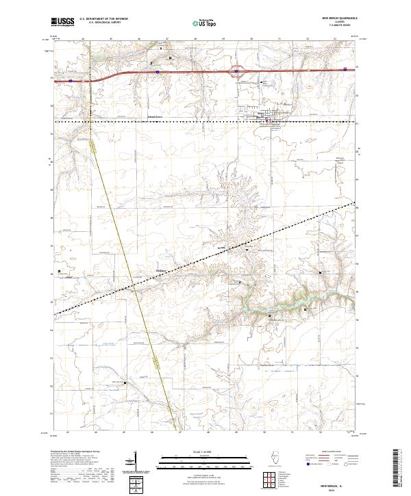
New Berlin serves as a primary hub for this portion of Central Illinois, where the developed streets of the village transition into the long-standing agricultural landscape of Island Grove. The terrain is defined by the winding paths of Spring Creek and Lick Creek, which carved valleys across the prairie and influenced the placement of early rural infrastructure. This area contains a high concentration of memorial sites for genealogists, including Saint John's Lutheran Cem near the town center and more remote locations like Luken Cem and Hodgerson Cem further south.
Find a feature on this map
70 named features on this map. Tap any name to fly to it.
Don’t see what you’re looking for? This feature index may not catch every label — zoom into the map to look around manually.
Map Details
Editions of this 2024 New Berlin Map
This is the sole edition of this map. No revisions or reprints were ever made.