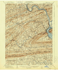
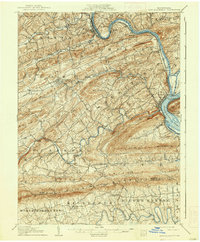
1907 Map of New Bloomfield
USGS Topo · Published 1944About this map
Juniata River and Susquehanna River define the industrial and transport corridors of Perry County at the dawn of the twentieth century. The convergence of these waters at Duncannon creates a nexus for the Pennsylvania RR (Middle Division) and various river-crossing infrastructure, including the Juniata Bridge and Clarks Ferry. Inland, the landscape is dictated by the parallel ridges of Mahanoy Ridge and Blue Mountain, where small agrarian and industrial pockets like Juniata Furnace and Kings Mill reflect a localized economy tied to natural resources.
Find a feature on this map
93 named features on this map. Tap any name to fly to it.
Don’t see what you’re looking for? This feature index may not catch every label — zoom into the map to look around manually.
Map Details
Editions of this 1907 New Bloomfield Map
6 editions found
Other maps of this area

1892 · Harrisburg
USGS Topo · 1:62,500

1893 · Millersburg
USGS Topo · 1:62,500

1899 · Harrisburg
USGS Topo · 1:62,500

1904 · Carlisle
USGS Topo · 1:62,500

1906 · New Cumberland
USGS Topo · 1:62,500

1907 · New Bloomfield
USGS Topo · 1:62,500

1907 · Millerstown
USGS Topo · 1:62,500

1919 · Newville
USGS Topo · 1:62,500

1924 · Harrisburg
USGS Topo · 1:62,500

1925 · Mifflintown
USGS Topo · 1:48,000