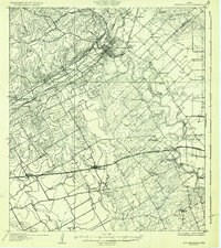
1927 Map of New Braunfels
USGS Topo · Published 1927About this map
The New Braunfels area in the late 1920s is defined by a dense intersection of industrial enterprise and central Texas river systems. The Guadalupe River and Comal R anchor the landscape, while the presence of the Lime Works and a Brick Plant near McQueeney signal the era's local manufacturing base. The map reveals an intricate network of rural education and community centers, from the Guadalupe College in the southeast to numerous country schools like Thornhill School and Schaffel School.
Find a feature on this map
44 named features on this map. Tap any name to fly to it.
Don’t see what you’re looking for? This feature index may not catch every label — zoom into the map to look around manually.
Map Details
Editions of this 1927 New Braunfels Map
3 editions found
Other maps of this area

1911 · San Marcos
USGS Topo · 1:125,000

1919 · San Marcos
USGS Topo · 1:125,000

1920 · Smiley
USGS Topo · 1:125,000

1920 · Smithsons Valley
USGS Topo · 1:62,500

1924 · New Braunfels No 4
USGS Topo · 1:48,000

1924 · San Marcos 3-c
USGS Topo · 1:48,000

1925 · New Braunfels No 1
USGS Topo · 1:48,000

1925 · Hunter No 3
USGS Topo · 1:48,000

1927 · New Braunfels
USGS Topo · 1:62,500

1927 · Smithson Valley
USGS Topo · 1:62,500