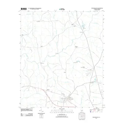
2011 Map of New Brockton
USGS Topo · Published 2011About this map
New Brockton sits as the primary hub in this Coffee County landscape, organized around a traditional grid near the New Brockton City Cemetery and the local New Brockton Post Office. The surrounding terrain is defined by the winding course of the Pea River, which is fed by numerous named tributaries including Indigo Creek, Harpers Mill Creek, and Coopers Creek. Historically significant family sites and smaller communities like Clintonville, Richburg, and Mixson are scattered across the quadrangle, connected by a network of county roads.
Find a feature on this map
94 named features on this map. Tap any name to fly to it.
Don’t see what you’re looking for? This feature index may not catch every label — zoom into the map to look around manually.
Map Details
Editions of this 2011 New Brockton Map
This is the sole edition of this map. No revisions or reprints were ever made.
Other maps of this area

1942 · Enterprise
USGS Topo · 1:125,000

1948 · Brundidge
USGS Topo · 1:62,500

1950 · Enterprise
USGS Topo · 1:62,500

1950 · Brundidge
USGS Topo · 1:62,500

1953 · Andalusia
USGS Topo · 1:250,000

1953 · Dothan
USGS Topo · 1:250,000

1954 · Dothan
USGS Topo · 1:250,000

1955 · Dothan
USGS Topo · 1:250,000

1957 · Andalusia
USGS Topo · 1:250,000

1960 · Brundidge SE
USGS Topo · 1:24,000