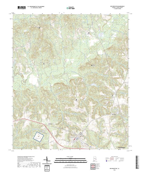
2024 Map of New Brockton
USGS Topo · Published 2024About this map
New Brockton sits at the heart of this Coffee County landscape, where the local road network converges near the New Brockton City Cem. The surrounding terrain is defined by a dense system of waterways, including the winding Pea River and its numerous tributaries such as Indigo Creek and Double Bridges Creek. This area shows a pattern of dispersed rural settlements and small agricultural communities like Richburg and Clintonville, each connected by a web of county roads.
Find a feature on this map
97 named features on this map. Tap any name to fly to it.
Don’t see what you’re looking for? This feature index may not catch every label — zoom into the map to look around manually.
Map Details
Editions of this 2024 New Brockton Map
This is the sole edition of this map. No revisions or reprints were ever made.
Other maps of this area

1942 · Enterprise
USGS Topo · 1:125,000

1948 · Brundidge
USGS Topo · 1:62,500

1950 · Enterprise
USGS Topo · 1:62,500

1950 · Brundidge
USGS Topo · 1:62,500

1953 · Andalusia
USGS Topo · 1:250,000

1953 · Dothan
USGS Topo · 1:250,000

1954 · Dothan
USGS Topo · 1:250,000

1955 · Dothan
USGS Topo · 1:250,000

1957 · Andalusia
USGS Topo · 1:250,000

1960 · Brundidge SE
USGS Topo · 1:24,000