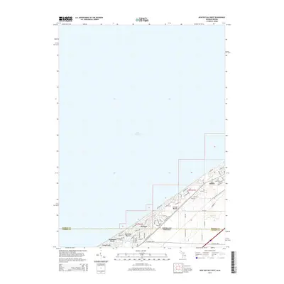
2014 Map of New Buffalo West
USGS Topo · Published 2014About this map
Lake Michigan dominates the northwestern portion of this coastal survey, where the state line between Michigan and Indiana divides a string of tight-knit shorefront communities. The terrain is defined by the transition from open water to the developed bluffs and lowlands of Berrien and LaPorte counties. In the northern section, New Buffalo serves as a local hub, with Pine Grove Cemetery and a network of residential streets like W Indiana St and W Detroit St set back from the shoreline.
Find a feature on this map
66 named features on this map. Tap any name to fly to it.
Don’t see what you’re looking for? This feature index may not catch every label — zoom into the map to look around manually.
Map Details
Editions of this 2014 New Buffalo West Map
This is the sole edition of this map. No revisions or reprints were ever made.
Other maps of this area

1930 · Three Oaks
USGS Topo · 1:62,500

1944 · Three Oaks
USGS Topo · 1:62,500

1953 · Michigan City West
USGS Topo · 1:24,000

1953 · Chicago
USGS Topo · 1:250,000

1957 · Chicago
USGS Topo · 1:250,000

1958 · Michigan City East
USGS Topo · 1:24,000

1958 · Springville
USGS Topo · 1:24,000
1962 · Michigan City West
USGS Topo · 1:24,000
1969 · Michigan City West
USGS Topo · 1:24,000
1969 · Michigan City East
USGS Topo · 1:24,000