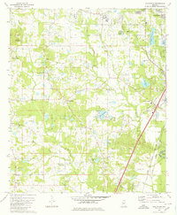
1980 Map of New Byram
USGS Topo · Published 1980About this map
Jackson's southern suburban expansion into Hinds Co is evident in this late-century landscape, where residential growth meets established rural infrastructure. The area is defined by a network of local congregations and educational sites, including the McCluer Sch, Big Creek Ch, and Bethesda Ch. Hydrology plays a central role in the terrain's character, with the Pearl River defining the eastern boundary and numerous smaller bodies such as Lake Catherine and Lake Ridgelea scattered throughout the territory.
Find a feature on this map
44 named features on this map. Tap any name to fly to it.
Don’t see what you’re looking for? This feature index may not catch every label — zoom into the map to look around manually.
Map Details
Editions of this 1980 New Byram Map
2 editions found
Other maps of this area

1903 · Jackson
USGS Topo · 1:125,000

1905 · Jackson
USGS Topo · 1:48,000

1906 · Florence
USGS Topo · 1:62,500

1908 · Jackson
USGS Topo · 1:62,500

1908 · Florence
USGS Topo · 1:62,500

1934 · Raymond
USGS Topo · 1:48,000

1937 · Raymond
USGS Topo · 1:62,500

1937 · Terry
USGS Topo · 1:48,000

1942 · Raymond
USGS Topo · 1:62,500

1943 · Terry
USGS Topo · 1:62,500