
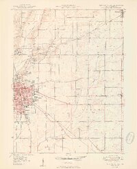
1950 Map of New Castle East
USGS Topo · Published 1950About this map
The Indiana Village for Epileptics defines the northern landscape of this Henry County area, a sprawling institutional complex featuring residential clusters like Colony No 1 and Colony No 2 alongside the settlement of Van Nuys. To the southwest, the growing city of New Castle serves as a major regional hub, its grid hosting the South Mound Cem, Baker Park, and several local schools including Hernly Sch and Parker Sch.
Find a feature on this map
40 named features on this map. Tap any name to fly to it.
Don’t see what you’re looking for? This feature index may not catch every label — zoom into the map to look around manually.
Map Details
Editions of this 1950 New Castle East Map
2 editions found
Other maps of this area

1948 · Lewisville
USGS Topo · 1:24,000

1949 · New Castle West
USGS Topo · 1:24,000

1950 · Dunreith
USGS Topo · 1:24,000

1950 · Lewisville
USGS Topo · 1:24,000

1953 · Cincinnati
USGS Topo · 1:250,000

1953 · Muncie
USGS Topo · 1:250,000

1956 · Muncie
USGS Topo · 1:250,000

1957 · Cincinnati
USGS Topo · 1:250,000

1960 · New Castle West
USGS Topo · 1:24,000

1960 · New Castle East
USGS Topo · 1:24,000