
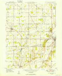
1949 Map of New Castle West
USGS Topo · Published 1949About this map
Prairie landscapes and structured agricultural grids define Henry County just after the war, where small crossroads communities and rural institutions mark the landscape west of the regional hub. Local landmarks such as the County Home and Western Air Field sit on the outskirts of New Castle, showing the expansion of civic and transport infrastructure during this era. The map provides a detailed view of the social fabric of the late 1940s, documenting several country congregations like Sugar Grove Ch and Mt Zion Ch, as well as the Sugar Grove Sch.
Find a feature on this map
38 named features on this map. Tap any name to fly to it.
Don’t see what you’re looking for? This feature index may not catch every label — zoom into the map to look around manually.
Map Details
Editions of this 1949 New Castle West Map
2 editions found
Other maps of this area

1948 · Lewisville
USGS Topo · 1:24,000

1950 · New Castle East
USGS Topo · 1:24,000

1950 · Dunreith
USGS Topo · 1:24,000

1950 · Lewisville
USGS Topo · 1:24,000

1953 · Cincinnati
USGS Topo · 1:250,000

1953 · Muncie
USGS Topo · 1:250,000

1956 · Muncie
USGS Topo · 1:250,000

1957 · Cincinnati
USGS Topo · 1:250,000

1960 · New Castle West
USGS Topo · 1:24,000

1960 · New Castle East
USGS Topo · 1:24,000