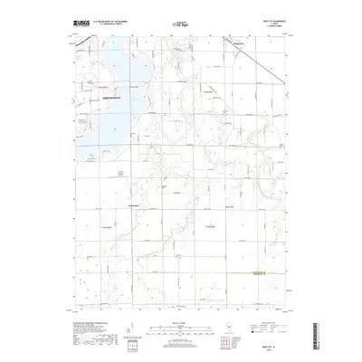
2018 Map of New City
USGS Topo · Published 2018About this map
Lake Springfield dominates the northwestern portion of this landscape, its fingers reaching inland at Long Bay and under the Lindsey Bridge. South of the Springfield city limits, the terrain transitions into a mosaic of rural townships and small settlements like Rochester, New City, and Beamington. This 2018 survey reveals a heavy emphasis on localized history through its numerous burial grounds, including Motterville Cem, Vigal Cem, and Zion Cem, which often represent early family plots or community foundations in Sangamon County.
Find a feature on this map
102 named features on this map. Tap any name to fly to it.
Don’t see what you’re looking for? This feature index may not catch every label — zoom into the map to look around manually.
Map Details
Editions of this 2018 New City Map
This is the sole edition of this map. No revisions or reprints were ever made.
Other maps of this area

1907 · Springfield
USGS Topo · 1:62,500

1922 · Divernon
USGS Topo · 1:62,500

1923 · Taylorville
USGS Topo · 1:62,500

1924 · Divernon
USGS Topo · 1:62,500

1925 · Taylorville
USGS Topo · 1:62,500

1930 · Springfield
USGS Topo · 1:62,500

1940 · Springfield
USGS Topo · 1:62,500

1950 · Springfield West
USGS Topo · 1:24,000

1950 · Springfield East
USGS Topo · 1:24,000

1954 · Mechanicsburg
USGS Topo · 1:62,500