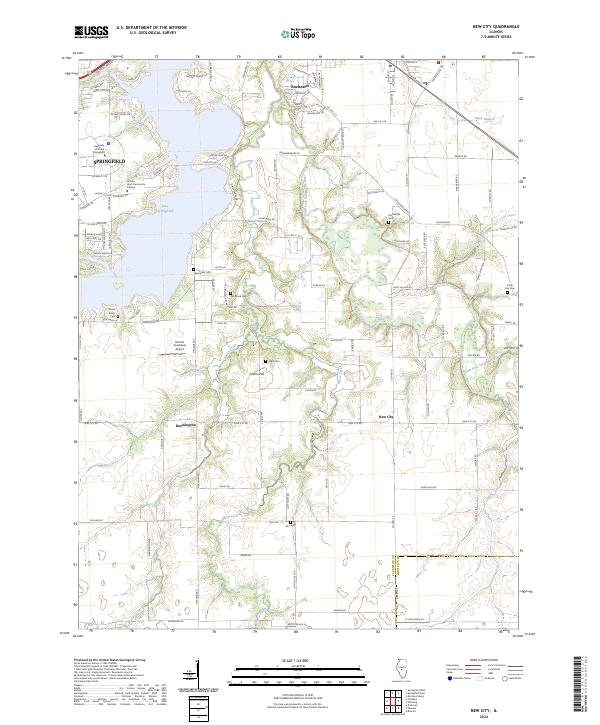
2024 Map of New City
USGS Topo · Published 2024About this map
Lake Springfield dominates the western portion of this Sangamon County landscape, creating a complex shoreline that separates the outskirts of Springfield from the more rural territories to the east. This area serves as a major educational and transit hub, anchored by the University of Illinois Springfield and Lincoln Land Community College. Southeast of the water, the terrain transitions into a grid of agricultural land and small settlements like New City and Beamington. A network of family-named cemeteries, including Joe Brunk Cem and Vigal Cem, are scattered across the landscape, providing significant points of interest for local genealogy. The South Fork Sangamon River and its tributaries, such as Horse Creek, carve through the eastern half of the map, defining the natural drainage patterns of this central Illinois prairie region.
Find a feature on this map
109 named features on this map. Tap any name to fly to it.
Don’t see what you’re looking for? This feature index may not catch every label — zoom into the map to look around manually.
Map Details
Editions of this 2024 New City Map
This is the sole edition of this map. No revisions or reprints were ever made.
Other maps of this area

1907 · Springfield
USGS Topo · 1:62,500

1922 · Divernon
USGS Topo · 1:62,500

1923 · Taylorville
USGS Topo · 1:62,500

1924 · Divernon
USGS Topo · 1:62,500

1925 · Taylorville
USGS Topo · 1:62,500

1930 · Springfield
USGS Topo · 1:62,500

1940 · Springfield
USGS Topo · 1:62,500

1950 · Springfield West
USGS Topo · 1:24,000

1950 · Springfield East
USGS Topo · 1:24,000

1954 · Mechanicsburg
USGS Topo · 1:62,500