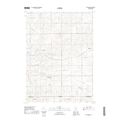
2018 Map of New Diggings
USGS Topo · Published 2018About this map
New Diggings and the surrounding Driftless Area landscape define this portion of Lafayette County, where the topography is etched by the Galena River and its numerous tributaries. The map documents a region deeply tied to its mining heritage, centered on the aptly named Lead Mine and the village of Benton. This 2018 survey reveals the persistent rural layout of the region, where family-named roads like Penny Benton Rd and Ollie Bell Rd connect small settlements such as Etna and White Oak. Historical researchers will find significant detail in the placement of local burial grounds, including the Masonic Cem, Shawnee Cem, and White Oak Cem, which anchor the local genealogical record. The drainage pattern is particularly intricate here, with Shullsburg Br, Ellis Br, and Diggins Cr carving through the terrain near the Horse Shoe Bend.
Find a feature on this map
63 named features on this map. Tap any name to fly to it.
Don’t see what you’re looking for? This feature index may not catch every label — zoom into the map to look around manually.
Map Details
Editions of this 2018 New Diggings Map
This is the sole edition of this map. No revisions or reprints were ever made.
Other maps of this area

1902 · Mineral Point
USGS Topo · 1:125,000

1911 · Elizabeth
USGS Topo · 1:62,500

1911 · Galena
USGS Topo · 1:62,500

1913 · Galena
USGS Topo · 1:62,500

1936 · Elizabeth
USGS Topo · 1:62,500

1952 · Shullsburg
USGS Topo · 1:24,000

1952 · Platteville
USGS Topo · 1:24,000

1952 · Calamine
USGS Topo · 1:24,000

1952 · Cuba City
USGS Topo · 1:24,000

1952 · Belmont
USGS Topo · 1:24,000