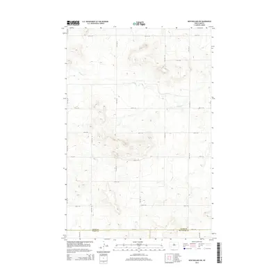
2014 Map of New England NW
USGS Topo · Published 2014About this map
Antelope Cr and Ash Cr define the natural drainage of this rural expanse along the western edge of the Dakotas. The landscape is marked by a rigorous section-line road network, including thoroughfares like 49th St SW and 121st Ave SW, reflecting the systematic agricultural development of the region. The map documents a significant three-county intersection where the southern boundary of Stark County meets both Slope County and Hettinger County. This 2014 survey serves as a precise record of the upland prairie and the winding watercourses that have historically shaped ranching and farming boundaries in this part of North Dakota.
Find a feature on this map
19 named features on this map. Tap any name to fly to it.
Don’t see what you’re looking for? This feature index may not catch every label — zoom into the map to look around manually.
Map Details
Editions of this 2014 New England NW Map
This is the sole edition of this map. No revisions or reprints were ever made.
Other maps of this area

1953 · Dickinson
USGS Topo · 1:250,000

1957 · Dickinson
USGS Topo · 1:250,000

1959 · Dickinson South
USGS Topo · 1:24,000

1961 · Daglum
USGS Topo · 1:62,500

1962 · Belfield SE
USGS Topo · 1:24,000

1973 · New England NW
USGS Topo · 1:24,000

1973 · New England
USGS Topo · 1:24,000

1973 · Schefield
USGS Topo · 1:24,000

1973 · New England SW
USGS Topo · 1:24,000
1973 · South Heart
USGS Topo · 1:24,000