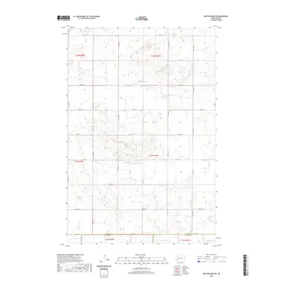
2020 Map of New England NW
USGS Topo · Published 2020About this map
Antelope Cr meanders across this rural section of Stark County, defining the drainage patterns of a landscape segmented by a precise grid of sectional roads. This survey reveals the intersecting boundaries of three North Dakota counties at its southern edge, where the Stark Co Slope Co and Stark Co Hettinger Co lines meet. The terrain is dominated by high prairie ridges and coulees, with Ash Cr flowing through the northern reaches. The area is defined by its vast agricultural layout, traced by miles of local roads such as 48th St SW and 120th Ave SW. This 2020 edition provides a clear record of the modern rural infrastructure and land management divisions within the Public Land Survey System townships of T137N and T138N.
Find a feature on this map
26 named features on this map. Tap any name to fly to it.
Don’t see what you’re looking for? This feature index may not catch every label — zoom into the map to look around manually.
Map Details
Editions of this 2020 New England NW Map
This is the sole edition of this map. No revisions or reprints were ever made.
Other maps of this area

1953 · Dickinson
USGS Topo · 1:250,000

1957 · Dickinson
USGS Topo · 1:250,000

1959 · Dickinson South
USGS Topo · 1:24,000

1961 · Daglum
USGS Topo · 1:62,500

1962 · Belfield SE
USGS Topo · 1:24,000

1973 · New England NW
USGS Topo · 1:24,000

1973 · New England
USGS Topo · 1:24,000

1973 · Schefield
USGS Topo · 1:24,000

1973 · New England SW
USGS Topo · 1:24,000
1973 · South Heart
USGS Topo · 1:24,000