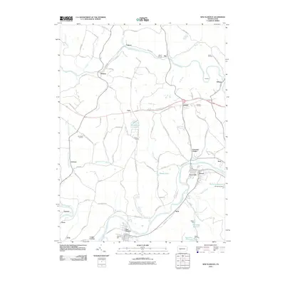
2010 Map of New Florence
USGS Topo · Published 2010About this map
Blacklick Creek and the Conemaugh River define the industrial and agricultural landscape of this Western Pennsylvania corridor. The survey highlights a series of small riverside and rail settlements, including New Florence, Seward, and Robindale Heights, many of which developed around the transportation networks of the valley. Significant infrastructure is visible along the riverbanks, notably at Conpitt Junction and the various power plants and dams that harnessed local water resources. For genealogists, the map preserves the locations of several community burial grounds such as Saint Marys Cemetery, Bethel Cemetery, and Armagh Cemetery. The presence of Sugar Run Reservoir and High Ridge Reservoir underscores the importance of water management in supporting the region's utilities and growing populations during the early twenty-first century.
Find a feature on this map
92 named features on this map. Tap any name to fly to it.
Don’t see what you’re looking for? This feature index may not catch every label — zoom into the map to look around manually.
Map Details
Editions of this 2010 New Florence Map
This is the sole edition of this map. No revisions or reprints were ever made.
Other maps of this area

1902 · Indiana
USGS Topo · 1:62,500

1902 · Barnesboro
USGS Topo · 1:62,500

1904 · Barnesboro
USGS Topo · 1:62,500

1904 · Johnstown
USGS Topo · 1:62,500

1907 · Johnstown
USGS Topo · 1:62,500

1920 · New Florence
USGS Topo · 1:62,500

1921 · New Florence
USGS Topo · 1:48,000

1922 · New Florence
USGS Topo · 1:62,500

1943 · Punxsutawney
USGS Topo · 1:125,000

1944 · New Florence
USGS Topo · 1:62,500