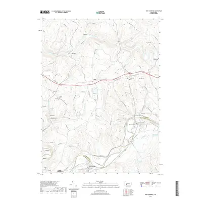
2019 Map of New Florence
USGS Topo · Published 2019About this map
The Conemaugh River corridor serves as a central artery through this Indiana and Westmoreland County landscape, shaping the development of valley settlements like New Florence and Seward. The terrain is marked by significant elevation changes, with ridges rising away from the river toward summits like Squirrel Hill. This area is characterized by a high density of small, dispersed communities and historical burial grounds, including the Germany United Methodist Church Cem and the Armagh Old Presbyterian Cem, which reflect the region's long-established religious and social ties. Industrial and infrastructure influences are evident at Conpitt Junction and the presence of several water management sites such as Big Spring Reservoir and High Ridge Reservoir. The map details a complex network of rural roads, such as Claghorn Rd and Rte 259, connecting these highland and riverside hamlets.
Find a feature on this map
109 named features on this map. Tap any name to fly to it.
Don’t see what you’re looking for? This feature index may not catch every label — zoom into the map to look around manually.
Map Details
Editions of this 2019 New Florence Map
This is the sole edition of this map. No revisions or reprints were ever made.
Other maps of this area

1902 · Indiana
USGS Topo · 1:62,500

1902 · Barnesboro
USGS Topo · 1:62,500

1904 · Barnesboro
USGS Topo · 1:62,500

1904 · Johnstown
USGS Topo · 1:62,500

1907 · Johnstown
USGS Topo · 1:62,500

1920 · New Florence
USGS Topo · 1:62,500

1921 · New Florence
USGS Topo · 1:48,000

1922 · New Florence
USGS Topo · 1:62,500

1943 · Punxsutawney
USGS Topo · 1:125,000

1944 · New Florence
USGS Topo · 1:62,500