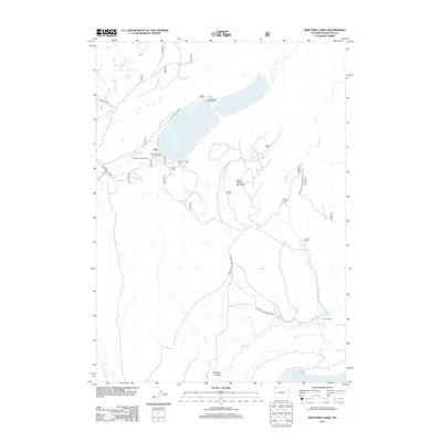
2012 Map of New Fork Lakes
USGS Topo · Published 2012About this map
New Fork Lakes and the surrounding high-country landscape of Sublette County define this 2012 survey. The area is characterized by a network of seasonal recreation sites and historical ranching properties, including the Z Bar U Ranch and Lozier Ranch. The topography is marked by significant elevations such as Little Flattop Mountain and the low-lying Dumphy Hollow near the southern boundary. Water is the primary geographic driver here, with the New Fork River feeding into the lakes, while Willow Cr and Deadman Cr drain the eastern slopes. The presence of specialized sites like the New Fork Scout Camp and various campgrounds, including The Narrows Campground, reflects the region's long-standing use for wilderness recreation and youth summer programs. Local transit is limited to a handful of improved roads like New Fork Lake Rd and more primitive paths such as the Moccasin Trl.
Find a feature on this map
22 named features on this map. Tap any name to fly to it.
Don’t see what you’re looking for? This feature index may not catch every label — zoom into the map to look around manually.
Map Details
Editions of this 2012 New Fork Lakes Map
This is the sole edition of this map. No revisions or reprints were ever made.
Other maps of this area

1907 · Gros Ventre
USGS Topo · 1:125,000

1909 · Fremont Peak
USGS Topo · 1:125,000

1910 · Gros Ventre
USGS Topo · 1:125,000

1939 · Big Piney
USGS Topo · 1:125,000

1942 · Big Piney
USGS Topo · 1:125,000

1955 · Driggs
USGS Topo · 1:250,000

1955 · Preston
USGS Topo · 1:250,000

1955 · Thermopolis
USGS Topo · 1:250,000

1955 · Lander
USGS Topo · 1:250,000

1958 · Driggs
USGS Topo · 1:250,000