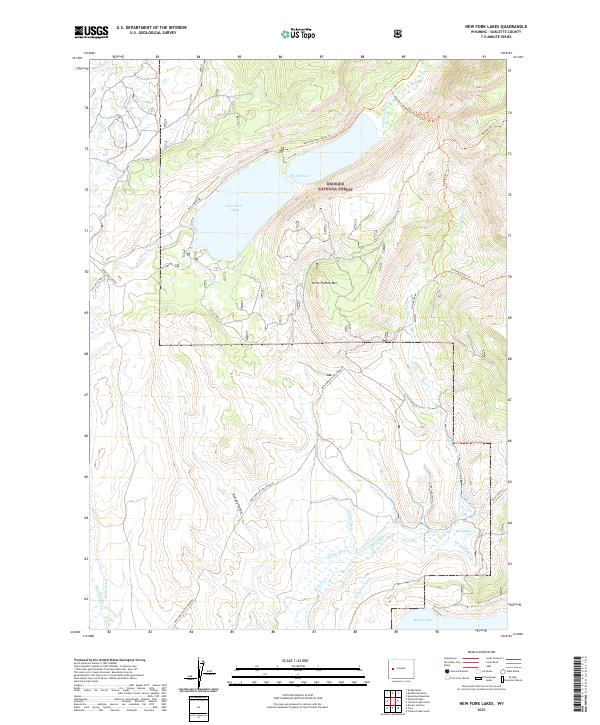
2021 Map of New Fork Lakes
USGS Topo · Published 2021About this map
New Fork Lakes and the surrounding wilderness of the Bridger National Forest dominate this landscape, where the New Fork River flows through the high country. The map illustrates a complex network of early irrigation efforts in the southern flats, featuring named infrastructure like the Graham Ditch, Josephine Ditch, Dodge Ditch, and Rahm Ditch. These waterways highlight the legacy of ranching and water management near Dumphy Hollow. To the north, the terrain rises sharply toward Little Flattop Mtn, accessible via a system of backcountry routes such as the Doubletop Trl and the New Fork/Porcupine Trl. This area, including the narrow passage at The Narrows, remains a vital corridor for both natural water flow and recreational access at the Scout Camp.
Find a feature on this map
34 named features on this map. Tap any name to fly to it.
Don’t see what you’re looking for? This feature index may not catch every label — zoom into the map to look around manually.
Map Details
Editions of this 2021 New Fork Lakes Map
This is the sole edition of this map. No revisions or reprints were ever made.
Other maps of this area

1907 · Gros Ventre
USGS Topo · 1:125,000

1909 · Fremont Peak
USGS Topo · 1:125,000

1910 · Gros Ventre
USGS Topo · 1:125,000

1939 · Big Piney
USGS Topo · 1:125,000

1942 · Big Piney
USGS Topo · 1:125,000

1955 · Driggs
USGS Topo · 1:250,000

1955 · Preston
USGS Topo · 1:250,000

1955 · Thermopolis
USGS Topo · 1:250,000

1955 · Lander
USGS Topo · 1:250,000

1958 · Driggs
USGS Topo · 1:250,000